Pantani

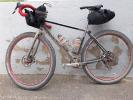
From Cottanello to Casperia [ altre info ]

cottanello f.cerro casperia

Details
Difficulty
Data
Km
29.73Km
Up
1230.00
Down
1365.00
Ends altitude
388.00
Max Altitude
1104.00
Min Altitude
388.00
Start altitude
523.00
Sponsored by
Rent your bikes from Bar. No hassle, just fun!

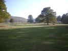
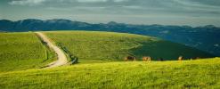
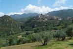
A 30km long ride from Cottanello to Casperia, across Pratoni and more wildness

Inside your pages
Use this code to expose this track inside your own pages (Website/App)

1. Paste this code inside your page

<div class='track-wrapper'>
  <iframe id='bbi-track-1021' class='bbi-track' allow='encrypted-media' allowfullscreen='' gesture='media' height='400' src='https://bbikeitaly.it/track-export/121' title='Pantani' ></iframe>
</div>

2. Use CSS code for a better design (optional)

<style>
.track-wrapper {
  position: relative;
  overflow: hidden;
  padding-top: 56.25%;
}
.bbi-track {
  position: absolute;
  top: 0;
  left: 0;
  width: 100%;
  height: 100%;
  border: 0;
}
</style>
            

This task is usually done by your Website/App mantainer. As registered Business, you can also rely on BBike Italy tech support

Tracks

Piani di Cottanello con deviazione verso il valico di Fontecerro e Fontelallo. Più panoramica Monte Terminillo e rientro a Cottanello. Alcune discese sono impegnative.bellissimo giro.
Da Cottanello ai Pratoni
BB Cottanello, Monte Civitella, Via pià di Selve
From Cottanello to Greccio
Discover the lovely valley with one day trip